Posts

De Young Museum at Golden Gate Park

Image
The de Young Museum, also known as the M. H. de Young Memorial Museum, is a fine arts museum located in San Francisco's Golden Gate Park. It is named for early San Francisco newspaperman M. H. de Young. The museum opened in 1895 as an outgrowth of the California Midwinter International Exposition of 1894 (a fair modeled on the Chicago World's Columbian Exposition of the previous year). It was housed in an Egyptian style structure which had been the Fine Arts Building at the fair. The building was badly damaged in the earthquake of 1906, closing the building for a year and a half for repairs. Before long, the museum's steady development called for a new space to better serve its growing audiences. Michael de Young responded by planning the building that would serve as the core of the de Young Museum facility through the 20th century. Louis Christian Mullgardt, the coordinator for architecture for the 1915 Panama-Pacific International Exposition, designed the Spanish-Plate...
Exploratorium of Fine Arts in San Francisco

Image
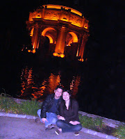
The task of creating a Palace of Fine Arts for the 1915 Panama-Pacific International Exposition fell to the architect Bernard R. Maybeck, then fifty years old and known for his innovative ideas. Setting to work on this new project, he chose as his theme a Roman ruin, mutilated and overgrown, in the mood of a Piranesi engraving. But this ruin was not to exist solely for itself to show "the mortality of grandeur and the vanity of human wishes .... " Although it was meant to give delight by its exterior beauty, its purpose was also to offer all visitors a stimulating experience within doors. In playing host to the Panama-Pacific International Exposition, The Fair, which opened on February 20, 1915, San Francisco was honoring the discovery of the Pacific Ocean and the completion of the Panama Canal; it was also celebrating its own resurrection after the shattering earthquake and fire of 1906.   The problems of choosing the exact site in the city had finally been overcome a...

South African Anthem and Inauguration on Stamp

Image
Nkosi Sikelel' iAfrika was composed in the year 1897 by Enoch Sontonga, a Methodist school teacher. It was originally sung as a church hymn but later became an act of political defiance against the apartheid government. Die Stem van Suid-Afrika is a poem written by C.J. Langenhoven in 1918 and was set to music by the Reverend Marthinus Lourens de Villiers in 1921.[2] Die Stem was the co-national anthem[3] with God Save the King/Queen from 1936 to 1957, when it became the sole national anthem until 1995. The South African government adopted both songs as national anthems from the year 1994, when they were performed at Nelson Mandela's inauguration.[4] They were merged in 1997 to form the current anthem. The new English lyrics were adapted from the last four lines of the first stanza of The Call of South Africa (the English version of Die Stem), and were modified to reflect hope in post-apartheid South African society.

The Mill Network of the Netherlands

Image
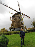
The Kinderdijk-Elshout mill network is an outstanding man-made landscape that bears powerful testimony to human ingenuity and fortitude over a millennium in draining and protecting an area by the development and application of hydraulic technology.  It is located in the north-western comer of the Alblasserwaard. It drained the internal drainage districts of De Overwaard and De Nederwaard until 1950, when the mills were closed. The 19 mills that form this group of monuments are all in operating condition. The Alblasserwaard is bounded by the rivers Lek to the north, Merwede to the south, and Noord to the south. The properties consist of discharge sluices, Water Board Assembly Houses, pumping stations, and brick and wooden mills. Owing to changed technical requirements, the discharge sluices were reduced to two and reconstructed in the mid-1980s. The Water Board Assembly Houses of De Overwaard and De Nederwaard survive intact. The former was built in 1581 and purch...

Wat Mahathat in Ayutthaya Historical Park

Image
The Ayutthaya historical park covers the ruins of the old city of Ayutthaya, Thailand. The city of Ayutthaya was founded by King Ramathibodi I in 1350 and was the capital of the country until its destruction by the Burmese army in 1767. In 1969 the Fine Arts Department began with renovations of the ruins, which became more serious after it was declared a historical park in 1976. The park was declared a UNESCO World Heritage Site in 1981. Thirty-five kings ruled the Ayutthaya kingdom during its existence. King Narai (1656 CE to 1688 CE) not only held court in Ayutthaya but also from his palace in the nearby city of Lopburi, from where he ruled 8–9 months in the year. Built during Ayutthaya period, Wat Mahathat temple was then known as Wat Salak. Soon after Bangkok was established as the capital of Siam,[3] the temple became strategically situated in between the newly-built Grand Palace and Front Palace (residence of the vice-king). As a result, the temple was used for royal ceremon...

Angkor Wat, Angkor Thom and Ta Prohm in Siem Reap

Image
Angkor Wat was built for King Suriyavarman II in the 12th century as his state temple and capital city.  As the best preserved temple, Angkor Wat is the only is the only one to have remained a significant religious center since its foundation- first Hindu dedicated to god Vishnu.  The temple has become a symbol of Cambodia   appearing on its national flag and is the country's prime attraction to visitors.   Angkor Thom was the last and most enduring capital of the Khmer empire.  It was established in the late 12th century by King Jayavarman VII.  It covers an area of 9 square kms.  One inscription found in the city refers to Jayavarman as the groom and the city his bride.  The Bayon was built int eh early 13th century as the official state temple of the Mahayana's Buddhist Kign Jayavarman VII.  Its most distinctive feature is the multitude of serene and massive stone faces on many towers. Ta Prohm is originally callled Raja...

La Grand Palace in Brussels

Image
The Grand-Place is an outstanding example of the eclectic and highly successful blending of architectural and artistic styles that characterizes the culture and society of this region. Through the nature and quality of its architecture and of its outstanding quality as a public open space, it illustrates in an exceptional way the evolution and achievements of a highly successful mercantile city of northern Europe at the height of its prosperity. The earliest written reference to the Nedermarckt (Lower Market), as it was originally known, dates from 1174. The present name came into use in the last quarter of the 18th century. It is located on former marshland on the right bank of the River Senne, to the east of the castellum, a defensive outwork of the castle built around 977 by Charles of France, Duke of Lower Lotharingia. The marsh was drained in the 12th century.  The present rectangular outline of the Grand'Place has developed over the centuries as a result of successiv...