Posts

Showing posts from 2012

Wat Mahathat in Ayutthaya Historical Park

Image
The Ayutthaya historical park covers the ruins of the old city of Ayutthaya, Thailand. The city of Ayutthaya was founded by King Ramathibodi I in 1350 and was the capital of the country until its destruction by the Burmese army in 1767. In 1969 the Fine Arts Department began with renovations of the ruins, which became more serious after it was declared a historical park in 1976. The park was declared a UNESCO World Heritage Site in 1981. Thirty-five kings ruled the Ayutthaya kingdom during its existence. King Narai (1656 CE to 1688 CE) not only held court in Ayutthaya but also from his palace in the nearby city of Lopburi, from where he ruled 8–9 months in the year. Built during Ayutthaya period, Wat Mahathat temple was then known as Wat Salak. Soon after Bangkok was established as the capital of Siam,[3] the temple became strategically situated in between the newly-built Grand Palace and Front Palace (residence of the vice-king). As a result, the temple was used for royal ceremon

Angkor Wat, Angkor Thom and Ta Prohm in Siem Reap

Image
Angkor Wat was built for King Suriyavarman II in the 12th century as his state temple and capital city.  As the best preserved temple, Angkor Wat is the only is the only one to have remained a significant religious center since its foundation- first Hindu dedicated to god Vishnu.  The temple has become a symbol of Cambodia   appearing on its national flag and is the country's prime attraction to visitors.   Angkor Thom was the last and most enduring capital of the Khmer empire.  It was established in the late 12th century by King Jayavarman VII.  It covers an area of 9 square kms.  One inscription found in the city refers to Jayavarman as the groom and the city his bride.  The Bayon was built int eh early 13th century as the official state temple of the Mahayana's Buddhist Kign Jayavarman VII.  Its most distinctive feature is the multitude of serene and massive stone faces on many towers. Ta Prohm is originally callled Rajavihara and is located 1 kilometer east of Angk

La Grand Palace in Brussels

Image
The Grand-Place is an outstanding example of the eclectic and highly successful blending of architectural and artistic styles that characterizes the culture and society of this region. Through the nature and quality of its architecture and of its outstanding quality as a public open space, it illustrates in an exceptional way the evolution and achievements of a highly successful mercantile city of northern Europe at the height of its prosperity. The earliest written reference to the Nedermarckt (Lower Market), as it was originally known, dates from 1174. The present name came into use in the last quarter of the 18th century. It is located on former marshland on the right bank of the River Senne, to the east of the castellum, a defensive outwork of the castle built around 977 by Charles of France, Duke of Lower Lotharingia. The marsh was drained in the 12th century.  The present rectangular outline of the Grand'Place has developed over the centuries as a result of successiv

The Four Major Town Houses by Victor Horta

Image
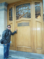
The appearance of Art Nouveau in the closing years of the 19th century marked a decisive stage in the evolution of architecture, making possible subsequent developments, and the four town houses of Victor Horta in Brussels (Hôtel Tassel, Hôtel Solvay, Hôtel van Eetvelde, Maison et Atelier Horta) bear exceptional witness to its radical new approach. They brilliantly illustrate the transition from the 19th to the 20th centuries in art, thought and society.    The stylistic revolution represented by these works is characterized by their open plan, the diffusion of light, and the brilliant joining of the curved lines of decoration with the structure of the building. The Hôtel Tassel can be considered the founding work of Art Nouveau.    Commissioned by Professor Emile Tassel in 1893, it was the first work in which Horta was able to realize his original conception of architecture. The house was finished in 1894, but Horta continued designing the furniture for some years. After the Secon

Autumn in Siberia (Part 1)

Image
Ulaanbaatar, Mongolia was the venue for the Hepatitis C and Co-infections conference which I attended together with two other gastroenterologists from Cebu, Dr. Arlene Kuan and Dr. Jenny Limquiaco. While reviewing the world map (which I always do before travelling), I can see that China was below Mongolia while Russia was above it. “I’d love a side trip to the Asian side of Russia”, I told my wife.  The city of Ulan-Ude, one of Russian Siberia’s major cities was just an hour and 15 minutes by plane from Mongolia. Siberia conjures images of a perpetually cold and dreary place where prisoners and outcasts were exiled like in the movie Gulag, a Russian forced labor camp, which I have watched a few times during my childhood. This movie has somehow imprinted this scene in my mind. Is this the kind place I would want go? Tick encephalitis, Lyme disease, Hepatitis A were some of the diseases one might acquire while traveling to Siberia, I am warned by The Lonely Planet guidebook.

Guatemalan Anthem Lyricist on Stamps

Image
Written in response to a contest calling for a national anthem to be adopted, the first ever playing of the winning entry took place during a lyric-literary meeting taking place at the Colon Theater, the night of Sunday 14 March 1897, as one of the main events of the Central American Exposition, and the author of the music was decorated with a gold medal and honor diploma. (Ovalle had been known previously for setting to music "Himno Popular" (The People's Anthem) by the poet Ramón P. Molina. It is unclear whether the music used for Ovalle's work was the same as the music that was submitted for the national anthem competition.) The author of the lyrics, however, was submitted anonymously, it was not until 1911, when it was discovered that the author was the Cuban poet Jose Joaquin Palma, who on his deathbed was honored with a silver wreath placed on his head, while outside the public and the bands sang the Himno Nacional. The original lyrics were modified slight

The Russian with a Filipino Heart

Image
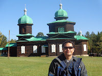
Tick encephalitis , Lyme disease , Hepatitis A , etc.- these are some of the diseases one might acquire when traveling to Siberia , As a doctor I was apprehensive about travelling to this side of the Earth.  The Lonely Planet guidebook which I read thoroughly gave these warnings.  Should I really go? I think I shouldn't.  But, this is a once in a lifetime experience.   Good that this book also mentioned a contact person- Petr Ishkin , a well-traveled Russian teacher who is proficient in English.  So I tried to email him, expecting he would never answer. He must receive hundreds of these requests, why would we bother to respond to mine?    I was requesting him to accompany and guide me through this Siberian rendezvous which brought me from island of Cebu , Philippines to Seoul , Korea , to Ulaanbaatar , Mongolia then to Ulan-ude , Siberia .  I was quite surprised  when he answered back the next day. After this, we were regularly exchanging emails and then we became Face

Mongolia's Orkhon Valley Cultural Landscape

Image
The Orkhon Valley Cultural Landscape (OVCL) lies in the central part of Mongolia, some 360 km southwest of Ulaanbaatar. The site covers 121,967 ha of grassland along the historic Orkhon River, and includes a buffer zone of 61,044 ha. The archaeologically rich Orkhon River basin was home of successive nomadic cultures which evolved from prehistoric origins in harmony with the natural landscape of the steppes and resulted in economic, social and cultural polities unique to the region. Home for centuries to major political, trade, cultural and religious activities of successive nomadic empires, the Orkhon Valley served as a crossroads of civilizations, linking East and West across the vast Eurasian landmass.   Over successive centuries, the Orkhon Valley was found very suitable for settlement by waves of nomadic people. The earliest evidence of human occupancy dates from the sites of Moiltyn Am (40,000- 15,000 years ago) and “Orkhon-7” which show that the Valley was first settle

The Serenity of Lake Baikal, Siberia

Image
As the vast evergreen forests of Russia 's Siberian taiga extend southward toward Mongolia , the ground rises and the terrain becomes more varied. The border between Siberian Russia and Mongolia is a natural divide here, with rugged hills and mountains forming series of wrinkles between the sprawling Russian forests to the north and rolling grasslands to the south.    About midway along this border, in a gigantic stone bowl nearly four hundred miles (636 km) long and almost fifty miles (80 km) wide, lies almost one quarter of the all the fresh water on earth--Lake Baikal.    Baikal is easily the largest lake in Eurasia , and it is just as easily the deepest lake in the world (1,620 metres). On the merits of magnitude alone the lake is renowned as one of the earth's most impressive natural wonders, and rightfully so--Baikal is so large that all of the rivers on earth combined would take an entire year to fill it. What fewer people realize, however, is that Bai

Hwaseong Fortress- Unesco World Heritage Site

Image
Hwaseong Fortress is an impressive structure from the latter part of the Joseon Dynasty (1392-1910) and the official fortress of Suwon-si, Gyeonggi-do. The fortress (constructed from 1794 to 1796) was built as a show of the King’s filial piety towards his father Jangheonseja and to build a new pioneer city with its own economic power. The fortress wall stretches for a total of 5.52km and has a great variety of military facilities that’s hard to find anywhere else. Four gates face each of the cardinal directions—Janganmun (north), Paldalmun (south), Changnyongmun (east), and Hwaseomun (west)—and the seven-arch style Sumun gates straddle the point where the nearby stream reaches the palace. Above the Sumun gates is a pavilion called Hwahongmun. Hwaseong Fortress was constructed under the guidance of Yu Hyeong-Won (1622-1673) and Jeong Yak-Yong (1762-1836), and is believed to have been constructed very scientifically. The fortress wall was built using Seokjae and Jeondo

The Jongmyo Shrine in Seoul

Image
Jongmyo Shrine was built by Lee Seong Gye (1335-1408), the first king and founding father of the Joseon Dynasty. It was a primary place of worship for kings throughout the Joseon Dynasty and has been registered as a UNESCO World Cultural Heritage site for its well-preserved ancient customs such as memorial services and traditional music. One of the many unique characteristics of Jongmyo Shrine is the 3-forked path of slightly raised roads that starts from in front of the main gate. The middle path is in honor of kings of the past and leads to Jeongjeon, where mortuary tablets of kings are preserved and memorial services are held. The tradition of enshrining successive kings was originally handed down from China, and has been well maintained. Jeongjeon has 19 different rooms in all, honoring 19 different kings. The east road of the shrine’s forked path is for the living king and the west is for the living prince. These two paths connect to a room where the king and the

Isle of Man Anthem on Europa Stamps

Image
This is a Europa stamp featuring the lyrics of the anthem of the Isle of Man on the tab.  This set is compose of two stamps values of  25p and 30p.  Previously the anthem of the Isle of Man was already feature here .  The anthem composer and lyricist were shown in the stamp.  A Europa stamps are special stamps issued by European postal administrations under the aegis of PostEurop and which have Europe as their central theme. Europa stamps should underline cooperation in the domain of posts, particularly as regards the promotion of philately and contribute to making the public aware of common roots, culture and history of Europe and common goals." In 2002, more than 50 European countries and territories issued Europa Stamps. The first issue dates from 1956 with 6 countries participating. From 1993 all the stamps have "Europa" inserted into the design in small print. For the new millennium in 2000, the common design once more replaced the common theme. The stamp

Trail Running in Liloan,Cebu

Image
I've been road running for the past 3 years. A few days ago however, I ventured into a different running adventure-  trail running.  Earlier on, I always wanted to run in varied off-road terrain, but friends warned me that injuries are higher in these types of run .    A colleague of mine, dislocated his knee and another had bruises in his shins and foot courtesy of the rocky terrain. My witty, humorous, fitness loving travelmate  Dr. Clifford "Ipyok" Aranas almost collapsed due to anaphylaxis after being bitten by a bee. Some even got lost (due to absence of signs) and became severely dehydrated (due to lack of water stations).  So, I told myself: "I'll have to prepare for this event"- the first ROX (Recreational Outdoor Xchange) Trail run in Liloan , Cebu sponsored by Salomon .    After much reading from various books and frequent site visits to Runner's World , I came up with these strategies, which I call the ABCDE strategy, for a successful trai

The Capilla Santa Ana Museum in Toledo

Image
On a recent visit to Toledo City, Cebu,  we had the opportunity to visit the Capilla Santa Ana Museum and Community Center in Diosdado Macapagal Highway, about 7 kilometers from the city center.  The museum is housed in a quaint chapel and hosts a variety of religious icons, art and relics from 18th and 19th century Europe. The exhibits are unique to this place as they are from all over Europe acquired through the fervent acquisition and collection of  a relative of the Gaite family. The family runs and maintains the museum.  We saw several relics of Saints (more than 10) and of the Cross where Jesus was nailed.  Several European renaissance paintings, wooden and bronze sculptures, vestments and sundry religious items are exhibited here.  There is even an 1859 Steinway piano displayed at the upper part of the chapel. Entrance fee is 200 pesos for foreign tourist and 100 and 50 pesos for local tourist and students respectively.   This is a must see for religious art lovers.

Yugoslavian Anthem Lyrics and Score on FDC

Image
The National anthem of the Kingdom of Yugoslavia (Kingdom of Serbs, Croats and Slovenes 1918–1929) was created in December 1918 from the national anthems of the Kingdom's main three constituent historical provinces: Croatia, Serbia and Slovenia. In those times the official authorities considered the three nations, Croats, Serbs and Slovenes as one nation with three names. The official language was thus called the Serbo-Croato-Slovene language. Although a law on the national anthem did not exist, the anthems of all three South Slavic nations were unified into a single anthem of the Kingdom. It started with a few measures from the Serbian anthem "Bože pravde", continued with a few lines from the Croatian anthem "Lijepa naša domovino", which were in turn followed by a few lines from the traditional Slovenian anthem "Naprej zastava slave". The anthem finished with some lines from the Serbian anthem again. It was officially used between 1919 and 1941

Puerto Princesa Underground River- Truly a World Wonder

Image
Entering into caves gave me goosebumps.  No video or photos can justify this truly world class experience. All your senses are stimulated- the sound of flying bats and sparrows, the cold air draft, the taste of dripping water( or bat urine?),the unforgettable subterranean whiff, the magnificent and jaw-dropping stone formations.  This is a heritage site all Filipinos should visit at least once in their lifetime. The Puerto Princesa Subterranean River National Park is located about 50 kilometres (30 mi) north of the city center of Puerto Princesa, Palawan, Philippines. The river is also called Puerto Princesa Underground River. The national park is located in the Saint Paul Mountain Range on the northern coast of the island. It is bordered by St. Paul Bay to the north and the Babuyan River to the east. The City Government of Puerto Princesa has managed the National Park since 1992. The park is also known as St. Paul's Subterranean River National Park, or St. Paul Underground Riv

Ukraine Anthem Lyrics on Stamp

Image
"Shche ne vmerla Ukraina" ("Ukraine has not yet perished") is the national anthem of Ukraine again since 1992  Before its re-adaptation a concourse for a national anthem among three patriotic songs was taken place with one of the other songs being Za Ukrainu by Mykola Voronyi.    The lyrics constitute a slightly modified original first stanza of the patriotic poem written in 1862 by Pavlo Chubynsky, a prominent ethnographer from the region of Ukraine's capital, Kiev, and were influenced by the words and themes of Poland's national anthem,  Poland Is Not Yet Lost. In 1863, Mykhailo Verbytsky, a western Ukrainian composer and a Greek-Catholic priest composed music to accompany Chubynsky's text. The first choral performance of the piece was at the Ukraine Theatre in Lviv, in 1864. The song was first the national anthem of the Ukrainian People's Republic, Carpatho-Ukraine and later the independent post-Soviet Ukraine. The stamp above was issued t

French Stamps at Petite France

Image
Mr. Han had a dream: to offer his fellow Koreans a taste of what inspired his love for France. This dream became the  Petite France project: an hour’s drive from Seoul, an urban area home to some 25 million residents, Mr. Han found a quiet location on the shore of Lake Gapyeong. Here he built something between a town and a museum: each house reflects French culture. Visitors can take a few days’ break here, staying in French-style houses furnished in the French manner with furniture imported directly from France. The distinctive architecture of Petite France has even proved a magnet for the film crew of Beethoven Virus, a hugely popular TV series in Korea. Here, the Little Prince is the guest of honour. Mr. Han takes a keen interest in French literature and enjoys the works of Antoine de Saint-Exupéry, in particular  The Little Prince. His favourite passage? The meeting with the fox, of course! In a country where over 350 different editions of  T

The Republic of Namirara

Image
Nami Island is an oasis for culture and leisure in peaceful harmony with humanity and nature. After a five-minute ferry ride, guests meet a forest of verdant trees holding up the sky and open grassy areas where ostriches, rabbits, squirrels, chipmunks, ducks and peacocks warmly welcome visitors in the midst of wild flowers.    On Nami Island, artists from all over the world show-off their talents and share the sense of peace of mind the island creates. The island is the site of Nami Island International Children's Book Festival (NAMBOOK) and other cultural events take place every weekend, making Nami one of the main cultural and artistic tourist attractions in Korea. In 2006, the island declared its cultural independence and was reborn as Naminara Republic.    They have their own national flag, anthem, currency, passport and phone cards, stamps, orthography and even a certification of citizenship. Nami is home to several galleries and is the site of the Song Museu

Sierra Leone National Anthem on Stamps

Image
Formerly a British colony, this west African nation adopted its national anthem, "High We Exalt Thee, Realm Of The Free", upon independence in 1961. The composer of the music, John Joseph Akar , was the first post independence Director of the Sierra Leone Broadcasting Service (SLBS) as well as the founder of the Sierra Leone national Dance Troupe, and the lyricist Clifford Nelson Fyle , was a professor at Fourah Bay College in Sierra Leone. John Joseph Akar (1927–1975) was a Sierra Leone-an of Lebanese descent entertainer, writer, and diplomat. He served as Sierra Leone-an Ambassador to the United States. Today, he is probably best known for composing the music of the Sierra Leone's National Anthem. Akar was born in the small town of Rotifunk, Moyamba District in the Southern P rovince of Sierra Leone, to an ethnic Sherbro mother and to a Lebanese father. Akar attended the E.U.B. primary school in Rotifunk, and proceeded to Albert Academy secondary school in Freetown.

Rarest Straits Settlements Cover

Image
This envelope is the only known cover used in Singapore bearing all four 1854 values on Indian stamps used in the Straits Settlements. This cover bears two 1/2 anna blue (Die 1), 1-anna Red (Die II), two 2-anna green and a cut-to-shape 4-anna blue and red (1st printing). All stamps are tied by a diamond-of-dots cancellation.

Elephant Stampede and the Latest Exhibits at the Singapore Philatelic Museum

Image
This is my third visit to the Singapore Philatelic Museum. The museum featured 5 current exhibits in addition to their permanent exhibit. Elephant Stampede- which traces the evolution of these giant creatures from mammoth to elephants, their shrinking habitats and the factors which led to their destruction.    It also highlighted the symbolism of elephants in Asian culture and religion- like how some kings reincarnated into elephants and the Hindu God Ganesh which had an half elephant body. T he exhibit ended on how we humans can help the elephants in their quest for survival. I enjoyed the interactive session, differentiating elephants from Africa and Asia. African elephants are bigger, have 5 toes and larger ears shaped like Africa while their Asian counterparts are smaller, have 4 toes and ears shaped like India.      I was able to see "Baby Emily", an elephant made of postage stamp designed by lo cal sculptor and artist Mr. Sun Yu-Li. This was in conjunction wit

Wulingyuan Scenic and Historic Interest Area- World Heritage Site

Image
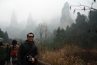
A spectacular area stretching over more than 26,000 ha in China's Hunan Province, the site is dominated by more than 3,000 narrow sandstone pillars and peaks, many over 200 m high. Between the peaks lie ravines and gorges with streams, pools and waterfalls, some 40 caves, and two large natural bridges. In addition to the striking beauty of the landscape, the region is also noted for the fact that it is home to a number of endangered plant and animal species. The site lies in the Wulingyuan District of the city of Dayong and covers the entire dra inage basin of the Suoxi Brook, which winds for 69 km through the site. The most notable feature, dominating about two-thirds of the site, are more than 3,000 quartzite sandstone pillars and peaks. Between the peaks are numerous ravines and gorges, many containing attractive streams, pools and waterfalls. The site also contains a number of karst features, notably some 40 caves which are concentrated on the banks of the Suoxiyu River and the

Gion- Kyoto's Geisha District

Image
Before we visited the Yasaka shrine, we passed by a a very old district in Kyoto- the Gion District. Our young guide told us that the movie "Memoirs of a Geisha" was filmed here. Originally developed in the Middle Ages, the district was built to accommodate the needs of travelers and visitors to the shrine. It eventually evolved to become one of the most exclusive and well-known geisha districts in all of Japan. The geisha in the Gion district do not refer to themselves as geisha; instead, Gion geisha use the local term geiko. While the term geisha means "artist" or "person of the arts", the more direct term geiko means essentially "a child of the arts" or "a woman of art". This neighborhood in Kyoto has two hanamachi (geiko communities): Gion Kōb u and Gion Higashi. Despite the considerable decline in the number of geisha in Gion in the last one hundred years, it is still famous for the preservation of forms of traditional archite